Science
Features
How ‘water detectives’ are protecting cities from flooding and scarcity, one stream at a time
From San Francisco to Victoria, the key to taming water is giving it what it wants.

Want to know keep up-to-date on what's happening in Victoria? Subscribe to our daily newsletter:
From San Francisco to Victoria, the key to taming water is giving it what it wants.
From San Francisco to Victoria, the key to taming water is giving it what it wants.
Get the news and events in Victoria, in your inbox every morning.
From San Francisco to Victoria, the key to taming water is giving it what it wants.

On a sunny winter day in San Francisco, Joel Pomerantz brakes his bike in Alamo Square Park near that famous spot where Victorian houses, the Painted Ladies, front the city’s modern skyline.
“Do you notice anything?” he asks me.
I brake too and look around, flummoxed. I lived in this city for 17 years and have been to this park countless times. Everything seems ordinary. On the paved path at our feet, Pomerantz points to an oblong puddle, which I would assume was left over from the last sprinkler watering.
“That?!” I ask, incredulous.
“Look closer,” he says, pointing to its ring of mossy scum. “That’s a sign that this water is nearly always here.” This diminutive puddle, which I have likely passed without noticing many times, is actually evidence of natural springs beneath the park that seep continually, he tells me. It’s a small sign of water’s hidden life, the actions this life-sustaining compound continues to pursue, despite our illusion that we control it. As climate change amplifies floods and droughts, people like Pomerantz are recognizing the importance of such minutiae that highlight water’s agency.
In his free time, Pomerantz hunts and maps ghost streams, the creeks and rivers that once snaked across the San Francisco Peninsula before humans filled them with dirt and trash or holstered them into pipes, then erected roads and buildings atop them. Such treatment of waterways has become standard practices in cities, where more than half of us live worldwide. Pomerantz has devoted three decades to exploring the city with water on his mind, making him a kind of water detective. His eyes see what others miss—like this puddle, or certain water-loving plants that are clues to lost creeks. He gestures toward the trees that line the park’s edge on Fulton Street. “Willows are like a flag,” he says. In fact, the name of this park is actually a plant clue: Alamo means “poplar” in Spanish, a species related to willows and other streamside trees.
A few blocks away, he checks for traffic, then guides me to a manhole in the middle of residential Turk Street near busy Divisadero. Cocking our heads, we hear the sound of rushing water. When that sound is constant, he says, especially in the middle of the night, it’s a creek or spring imprisoned in a sewer pipe, not somebody flushing.
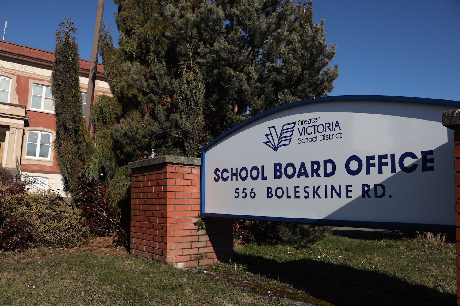
Pomerantz—who has published a map of San Francisco’s lost waterways on his Seep City website, advised local agencies as a consultant, and leads walking tours to share his hard-won knowledge—is not alone in his obsession. In Brooklyn, urban planner Eymund Diegel has mapped Gowanus Creek’s lost watershed. In Victoria, artist, poet, and environmental activist Dorothy Field worked with local historians and First Nations to track the hidden path of Rock Bay Creek, then installed signs and street medians inlaid with salmon mosaics to draw attention to where it still flows underground.

Field is part of a small group of enthusiasts who are advocating that the city of Victoria highlight the buried path of Rock Bay Creek on its planning maps and look for opportunities to excavate it from pipes and bring it back to the surface, hoping to emulate the success of creek advocates’ decades of work in next-door Oak Bay with Bowker Creek. Good candidates are green spaces where traces of the creek have made it too boggy to build upon: Alexander Park, Blackwood Park, Wark Street Park. Other opportunities emerge when buildings are torn down or redesigned. A project to rebuild housing at Evergreen Terrace along Blanshard and King could allow Victoria to bring part of Rock Bay Creek to the surface again, creating a natural feature for the residents and a place to absorb water and support biodiversity—if designers follow emerging best practices. It’s not enough to create an attractive water feature. For the stream to function as the system nature created, it needs adequate space and diverse forms of life.
Secret rivers, ghost streams, hidden creeks: learning of their existence arouses our innate attraction to mystery and our passion about the places we live. What we learn about the past triggers amazement because our quotidian landscape is so transformed. We’ve dramatically altered waterways outside of cities too. We’ve straightened rivers’ meanders for shipping, uncurled creeks to speed water away, drained and filled wetlands and lakes, and blocked off floodplains to create more farmland or real estate for buildings.

But our curiosity about water’s true nature is not idle, nor an indulgent wish to return to the past. Water seems malleable, cooperative, willing to flow where we direct it. But as our development expands and as the climate changes, water is increasingly swamping cities or dropping to unreachable depths below farms, generally making life—ours and other species’—precarious.
Floods and droughts are increasing in severity and frequency because of climate change, but also because we’ve taken so much space from water with our development decisions, including urban expansion, industrial agriculture, and concrete infrastructure designed to control water. We’ve filled in 87% of the world’s wetlands, intervened on two-thirds of the largest rivers, and doubled the paved area of our cities since 1992.
Signs of water’s persistence abound if we train ourselves to notice them. Supposedly vanquished waterways pop up stubbornly, in inconvenient ways. In Toronto, tilted houses on Shaw Street near the Christie Pits neighbourhood were long a local novelty, but most people didn’t know that the ghost of Garrison Creek was pulling them out of plumb. And in the wreckage of disasters like Superstorm Sandy or Hurricane Harvey, we see that homes built atop wetlands are the first to flood.
When our attempts to control water fail, we are reminded that it has its own agenda. Water finds its chosen path through a landscape, moulding it and being directed in turn. It has relationships with rocks and soil, plants and animals, from microbes to mammals like beavers and humans. To reduce the impacts of increasing floods and droughts, water detectives—Pomerantz, Field, and other ghost-stream enthusiasts; restoration ecologists; hydrogeologists; biologists; anthropologists; urban planners; landscape architects; and engineers—are now asking a critical question: What does water want?
Most modern humans have forgotten that water’s true nature is to flex with the rhythms of the earth, expanding and retreating in an eternal dance upon the land. In its liquid state, with sufficient quantity or gravity, water can rush across the land in torrential rivers or tumble in awe-inspiring waterfalls. But it is also inclined to linger to a degree that would shock most of us because our conventional infrastructure has erased so many of its slow phases, instead confining water and speeding it away. Slow stages are particularly prone to our disturbance because they tend to be in the flatter places—once floodplains and wetlands—where we are attracted to settle.
But when water stalls on the land, that’s when the magic happens, cycling water underground and providing habitat and food for many forms of life, including us. In that slowness, water forges its critical, complex relationships with life in local ecosystems. The key to greater resilience, say the water detectives, is to find ways to let water be water, to reclaim space for it to interact with the land in some approximation of natural patterns. For that reason, I’ve come to think of this international movement as “Slow Water.”
Like the Slow Food movement founded in Italy in the late twentieth century in opposition to fast food and all its ills, Slow Water approaches are bespoke: they work with local landscapes, climates, and cultures rather than try to control or change them.

Slow Water is rooted in an ethos of curiosity, respect, and reciprocity, an interweaving of nurture and need: for nature to provide for us, we must care for it. Kelsey Leonard is a Shinnecock citizen and assistant professor in the School of Environment, Resources, and Sustainability at the University of Waterloo in Ontario. As she explained to me and an audience of river researchers in an online talk in 2020, many Indigenous traditions don’t consider water to be a “what”—a commodity or a threat—but a “who.” Many Indigenous people not only believe that water is alive, but that it’s kin. “That type of orientation transforms the way in which we make decisions about how we might protect water,” she said. “Protect it in the way that you would protect your grandmother, your mother, your sister, your aunties.”
People deploying Slow Water approaches around the world are a diverse bunch. But they share an openness to moving from a control mindset to one of respect. As our long-held illusion that we can control water is crumbling in the face of escalating disasters, we understand, viscerally, that water always wins. Given that truth, it’s better to learn how to collaborate with water and enjoy the benefits that cooperation can bring.
That means paying close attention to water’s relationships with other entities, including underground rock and sand, microbes, and other tiny beings. Just south of the border in Seattle, Wash., urban creek restorers have pioneered a new approach that could inform work in Victoria to restore creeks for salmon.
***
Salmon are so elemental to Indigenous peoples who live along North America’s northwestern coast that for generations several nations have called themselves the “Salmon People.” But when settlers came, their forms of agricultural and urban development devastated the mighty fish. The new inhabitants cut down streamside vegetation that once slowed and absorbed rains, causing floods. They straightened curvy creeks to try to speed floodwater off the land, then armoured the sides to prevent erosion, but the faster flow gouged the riverbed. Later, urban planners and engineers funneled streams into buried pipes so they could build more city on top, disconnecting waterways from soil, plants and animals.
This pattern of urban development has been repeated worldwide, causing what ecologists call “urban stream syndrome.” The ailment is characterized by flash floods, unstable banks, reduced biodiversity, and high levels of contamination with nutrients and other pollutants. The hallowed salmon all but disappeared.
They are not alone in this decline. Our disruption of streams, wetlands, and floodplains has caused fish, amphibian, reptile, mammal, and bird populations in and around lakes and rivers to lose more than 81% of their populations, on average, between 1970 and 2012. This is not just a moral problem but a practical one. Lands and waters that remain rich in other life do a better job of providing water services, absorbing floods, releasing water in summer, soaking up greenhouse gases, and self-regulating, requiring less ongoing maintenance.
On a sunny fall afternoon in Seattle, I walk down a pathway to the Thornton Creek confluence, where the North and South Forks meet. Two restoration projects here to support salmon and stop regular urban flooding have created a lovely respite from the city. The water is clear; crows holler; squirrels race up willows, cottonwoods, and cedars. And these aboveground signs of life are just the proverbial tip of the iceberg. What makes the Thornton Creek restoration special is the water detectives’ attention to a mysterious area under the stream. Similar to the discovery of the mycorrhizal networks under forests, stream ecologists are learning more about what goes on in something called the hyporheic zone (Greek, hypo, “under,” and rheos, “flow”).
It’s a secret creek under the creek. Just below the streambed, the sediment and soil are filled with water. Here, groundwater pushes up into surface water and the stream forces water back down underground. Water within the hyporheic is also flowing downstream like the creek above it—but orders of magnitude more slowly. Time spent underground modulates water’s temperature, cooling streams during the hot summer months and warming them in the cold winter, creating a more stable environment for the fish who live there. Along a large river, the hyporheic zone can extend underground laterally more than a mile from the banks. For an urban creek like Thornton, the hyporheic can extend 30 feet on either side. The hyporheic is an ecotone, a liminal space known for high biodiversity because its unique critters mingle with neighbours from the surface and aquifer. Hyporheic zones are home to microbiomes that, like our own guts’ microbial diversity, are a determinant of wellness. Scientists call it the stream’s gut, or the liver of the river.
Thanks to slow water, critical physical, chemical, and biological processes happen here, including soil aeration, water oxygenation, pollution cleanup, waste decomposition, and food creation. Yet despite the feature’s importance, the recent Thornton Creek projects were among the world’s first to physically recreate a hyporheic zone in an urban stream—and to inoculate the sterile substrate with tiny life forms harvested from a nearby healthier streambed.
The repair of Thornton Creek began in the 1990s when the Seattle Parks and Recreation department began buying out homeowners and removing houses that flooded repeatedly to give the creek the room it steadfastly refused to relinquish. Thornton traverses 24 km, draining a nearly 30 square-kilometre watershed that’s home to 70,000 people. The two restoration projects’ spanned just under 500 m in total, a scope that might seem too small to make a difference. But for people who knew the creek’s historical shape, the routine flooding there was predictable; these spots were originally floodplains. Experts thought that handing them back to the creek could absorb significant water.
The projects’ champion was Katherine Lynch, a biologist working for Seattle Public Utilities. Earlier in her career, she’d worked on wilder, rural streams. When she was first assigned to urban creeks, she balked: “I thought, ‘Excuse me: I work on river systems. And now you want me to work on ditches? No thank you.’” She eventually realized that her resistance was rooted in sadness, a feeling that maybe urban creeks were beyond salvaging. Thornton Creek had a reputation as one of the worst. But early on, as she explored the riprapped channel, she found small signs of life, giving her hope.
Later, I speak by phone with Mike Hrachovec, an engineer with Natural Systems Design, the firm that devised the projects. He explains to me that when people straighten a meandering creek into a narrow channel, the water’s energy is funneled, speeding its pace. Additionally, in a city, rainfall often can’t soak into soil where it falls but instead runs off sprawling pavement and rooftops, creating much higher peak flows than in a natural landscape. Together these impacts create what Hrachovec calls a “firehose” effect.

The firehose sprays water down the channel “ten to one hundred times faster than historic rate,” cutting down into the earth. This is classic “fast water,” and it means that most of it doesn’t have time to soak into the ground in the channel or floodplain, significantly decreasing the amount of water locally available during dry periods. Historically, “streams had a much more consistent flow range between winter and summer,” Hrachovec says. A healthier system could help supply dry-season water in drought-stricken areas. Importantly, the firehose effect also scours away the sediment, gravel, wood debris, and nutrients making up the hyporheic zone.
Over the last couple of decades, stream ecologists worldwide have tried to repair damaged creeks by restoring their shape, from straight, deep channels to more natural sinuosity, a long, messy curl with strands separating and rejoining. To entice fish, they’ve plopped wood into the channels to create more habitat. Seattle Public Utilities planned to follow this approach and also wanted to restore Thornton Creek’s connection to its floodplain, a tactic that is becoming more common in restoration.
The idea is that by recreating some of the physical parts of a healthy stream, plants and animals will repopulate it: If you build it, they will come. Ecologists call this the “field of dreams” approach, after the classic 1989 baseball film. They found that it works—to a degree. But in the last decade or so, ecologists have been noticing that, in many cases, the life that returns isn’t very diverse. A lot of species are missing. Their absence prevents the stream from functioning as a healthy system. So “restored” urban streams often don’t solve flood hazards, water scarcity, or channel instability. Nor do they effectively clean pollutants, store carbon dioxide, or maintain themselves without ongoing “help” from humans that can be costly, fleeting, or misguided because people don’t fully understand all facets of the system.
Lynch realized that because fast water scoured away hyporheic zones, they were the missing link in urban stream restoration. When the hyporheic zone is washed away or depopulated, pollutants and waste can build up and larger creatures can go hungry. It’s akin to when humans have digestive issues because their gut fauna is deficient. But as far as she could tell, no one had taken the next step: to build, from scratch, a missing hyporheic zone, then repopulate the sterile area with microbial life.
She wanted to go for it. But urban stream restorations have big price tags, tight budgets, and high stakes: ensuring peoples’ properties don’t flood. Convincing any agency to stick its neck out to try something radically new is hard. Plus, there was a more basic hurdle, Lynch says. “People had no idea what I was talking about.”
So when budget concerns arose, one decision maker quickly axed the hyporheic element. In response, Lynch penciled out the cost and found that piece was just $300,000 out of the two sites’ combined $10.5 million USD budget. She also argued that if the restorationists could repair a stream’s natural systems, the creek might use and move sediment on its own, ultimately reducing the need to spend an average of $1 million a year dredging a nearby stormwater pond. Ultimately Lynch prevailed, in part by promising to study the design so scientists could weigh whether it worked and gather data to inform subsequent projects.
Paul Bakke, a hydrologist focused on geomorphology, did baseline measurements, which clearly showed that Thornton Creek’s hyporheic zone had been almost completely scraped away. For Bakke, the projects were personal. He’d grown up in the 1960s and ’70s along Thornton Creek, fishing for cutthroat trout and playing with water skeeters. Then, just before he entered high school, condos were built right along the creek’s edge, cutting off his access. “These old haunts that I really loved, that were my sort of wilderness, really . . . were suddenly not just blocked but being paved over,” he tells me via phone. “It was very upsetting.”
Lynch paired Bakke with Hrachovec to design the project, thinking the geomorphologist and the engineer would bring together very different perspectives. She wasn’t wrong. Their partnership was rife with intense disagreements. One of the biggest battles? Bakke wanted to put larger gravel on the streambed to allow water to move more easily into the hyporheic. Otherwise, he feared, superfine urban dust washing into the creek could “plug up” the downward flow. But Hrachovec worried that large gravel might allow too much water to move underground, drying out the surface stream in summer and killing fish. To sort it out, they ran tests on computer models and in a large sandbox, modeling stream dynamics and trying different aggregates, meanders, and wood placement.
Satisfied at last, in summer 2014, they put the bulldozers to work. Hrachovec and his team removed the berms and dug out an area five times wider than the stream. Then they replaced the missing hyporheic zone along the creek bed, layering in two and a half metres of gravel and sediment so its tiny residents could find a home.
Throughout they carefully placed logs to create tiny waterfalls, plunge pools, and pockets of nearly still water. These features dissipate the stream’s energy away from eroding the bank and force water down into the newly created hyporheic zone and up out of it, increasing circulation. Over time, gravel and silt fall out of the slowed water and build up behind the barriers, creating a gentle grade.
The monitoring the utility required allowed Bakke and Hrachovec to track the water flow by temperature and tracers to confirm it was moving into the hyporheic zone. Result! They found water mixing at 89 times the preconstruction rate. Seeing the stream function as nature, Bakke, and Hrachovec intended, the two designers were visibly relieved, shrugging off the months of anxiety. “They were high-fiving, laughing together,” Lynch recounts fondly.
But was that flow also supporting diverse life?
In a healthy stream, there’s a lot going on. Carnivorous fish eat crustaceans, worms, and aquatic insects. In the interstitial zone between the rocks on the stream bottom live even smaller creatures called meiofauna, less than a millimetre long. Their group includes such characters as nematodes, copepods (sort of like tiny shrimp), rotifers, and tardigrades (a.k.a. water bears).
Below that is the hyporheic zone. Some of the tiny critters dig tiny tunnels for themselves between the hyporheic zone and surface, keeping the soil aerated, allowing water to infiltrate. In turn, that moving water supports life, including salmon spawn. Adults lay eggs in the upper reaches of the hyporheic, in places where upwelling delivers higher oxygen levels to the developing fry.
Then there are the microbes, tiny ecosystem engineers. They metabolize inorganic matter into food for plants and bugs. They feed other organisms who live underground where there is no light for photosynthesis. They move organic matter and nutrients between the hyporheic zone and surface sediments and play a pivotal role in the nitrogen, phosphorus, and carbon cycles.
The “field of dreams” approach—the theory that restoring a stream’s natural shape can encourage displaced plants and animals to move back in—relies on critters migrating from healthy upstream habitats. But in many urban areas, the headwaters are buried under a parking lot or in pipes that cut off water from the hyporheic zone. And the gravel and sand the team installed on the stream bed to create a new zone were sterile. People working on the project realized that they might need to make another ground-breaking step: give their constructed hyporheic zone a biological jumpstart, akin to administering probiotics, or even a fecal transplant—to restore gut biomes.

Linda Rhodes, a microbiologist with the National Oceanic and Atmospheric Administration (NOAA), and stream ecologist Sarah Morley, also with NOAA, inoculated the engineered hyporheic zone with wild microbes and invertebrates they harvested in small baskets placed in the healthier Cedar River watershed nearby. They took a few baskets back to the laboratory to document captured species and buried the others in Thornton Creek’s restored hyporheic zones.
Invertebrates and microbes quickly colonized the areas. But even though the number of individuals was high, the biodiversity appeared to be relatively low, a sort of crows and cockroaches phenomenon. According to the duo’s 2021 paper in Water, a few of the new species proliferated, but most of the other species were similar to those in unrestored sections of the creek. And yet in the guts of some trout, Lynch found aquatic insects that had not been seen in Thornton Creek for at least 20 years. “The fish are better at sampling than we are,” she says. Rhodes and Morley are now conducting another study with more sensitive monitoring.
The scientists also noticed that the microbes who began living in the restored stream sections were much more active than those in nearby unrestored sections, indicating they were “getting goosed to do something,” Rhodes says—maybe build biofilms and biomass, clean pollutants or break down organic material. And the restored sections had seven times more hyporheic crustaceans, worms and insects, as well as much greater overall species diversity.
The water detectives had one more key question: Was the engineered hyporheic zone reducing the chemical pollution that runs off pavement, lawns, and other surfaces when it rains? Lynch had to search for three years to find a chemist who would conduct the research. “All of them said it could not be done,” she recalls. They said it was too difficult to track how long water stayed in the hyporheic zone and to measure whether chemicals were removed while the water spent time underground.
Lynch eventually reached Skuyler Herzog, then an engineer at the Colorado School of Mines, who specializes in the hyporheic zone. “He took the next plane out here,” Lynch recounts with glee. Actually, he drove, Herzog tells me. Still, after years of studying the hyporheic zone, he was thrilled to conduct tests on a real restoration. Lynch recruited University of Washington chemist Edward Kolodziej to help.
The researchers collected water samples from the stream and used mass spectrometry to measure different pollutants from storm runoff. They counted nearly 1,900. They also sent tracer dyes into an engineered plunge pool that pushed water into the hyporheic. That allowed them to monitor exit points two and 4.5 m downstream to determine how long a “packet” of water stayed under before rejoining surface flow. They found that water stayed under for 30 minutes to three hours or more.
They sampled water packets for the chemicals before they entered the stretches of hyporheic and after they emerged, and compared them with water in the surface flow. Just flowing downstream reduced about 17% of the chemicals by at least half. The short stretch of the hyporheic reduced 59% of the chemicals by at least half, and the long stretch, 78%. Because water spent so little time in those short hyporheic stretches, the team thinks the pollutants mostly got stuck on sediments or biofilms rather than being broken down immediately by microbes, although that decomposition is common over longer time periods.
Hrachovec says it is “profound and jaw-dropping” that such short hyporheic spans were able to reduce so much pollution. He adds, it was “astounding to contemplate how much good we could do if we had this more available.”
The Thornton Creek findings are encouraging. The neighbourhoods around the creek have not flooded since the restorations were finished in 2015, even during large storms. The stream’s temperature and flow are more consistent year-round. The city needs to dredge less often, saving money, and neighbours love spending time in the expanded green space. Yet the work also provides insight into the complexity of water’s relationships with tiny creatures and its subsurface, and how difficult it is to repair what we have damaged. That’s why giving a natural system as much of the space and ingredients it once had as possible will offer it the best chance of returning to a state in which it can deliver the benefits of Slow Water: flood control, water cleaning, storing water locally for dry periods, carbon storage, and support for diverse life.
The Thornton Creek studies can also inform an ever-growing number of green infrastructure projects in cities worldwide, including in Victoria. In Seattle, Lynch is now using the research to convince the city of the importance of a stream’s gut. Hyporheic restoration has become a formal part of the utilities’ creek projects—not guaranteed but routinely considered. Multiple hyporheic reconstructions are planned in three other creeks. Herzog is testing design improvements to increase water’s “residence time” in the hyporheic and is studying how much that increases cleansing.
Finding space for more natural water flows in an established city might seem difficult, but buildings are replaced more often than people think. The upcoming Evergreen Terrace redesign is just such an example. Cities can also reclaim land that floods repeatedly, as Seattle did. And even small projects in key places can make a difference. By restoring space in areas that were historically floodplains, Seattle has relieved important pinch points on Thornton Creek.

But it’s common sense that small projects can’t fully compensate for acres of lost space for water. “Stormwater runoff, biodiversity, flooding—these are watershed-scale problems,” Bakke says. That is why reconstructions need to be distributed in many places along a stream or river. In Victoria, unearthing Rock Bay Creek through Evergreen Terrace would be an important start. But water needs space along its route: in the parks, possibly near the site of its historic waterfall near Queen and Government streets, in corners of people’s yards. To absorb more floodwaters and strengthen stream systems, we need to link together as many natural spaces as possible throughout human habitats. Some of those may lie upstream, outside of city limits.
While full biological richness may not return to an urban creek like Thornton, there are worthy degrees of improvement. Success is relative, says Morley: “Neighbours love the project. I see kids there all the time.” It’s a place for people, both researchers and community members, to learn about how ecosystems function.
Nevertheless, Lynch and the water detectives won the ultimate stamp of approval in the fall of 2018, when Chinook salmon swam in from Puget Sound and spawned in the creek’s restored hyporheic zones. “That was just really emotional,” Lynch recalls. “We had done it. You can restore the hyporheic zone. You can restore natural processes to the extent that we are actually attracting salmon to the site to spawn.” It was enough to change her perspective on those urban “ditches.” A bit verklempt, she says, “I think there really is hope for the future.”
Erica Gies's book, Water Always Wins: Thriving in an Age of Drought and Deluge, is available at Victoria booksellers now.


.jpg)


.jpeg)
.jpg)


