Housing
Features
Langford’s growth, mapped
See our interactive map to keep track of what's happening in your neighbourhood

Want to know keep up-to-date on what's happening in Victoria? Subscribe to our daily newsletter:
See our interactive map to keep track of what's happening in your neighbourhood
See our interactive map to keep track of what's happening in your neighbourhood
Get the news and events in Victoria, in your inbox every morning.
See our interactive map to keep track of what's happening in your neighbourhood

This map will be updated over time. To make sure you don't miss a beat—and to get stories like this directly in your inbox twice every week—sign up for The Westshore newsletter.
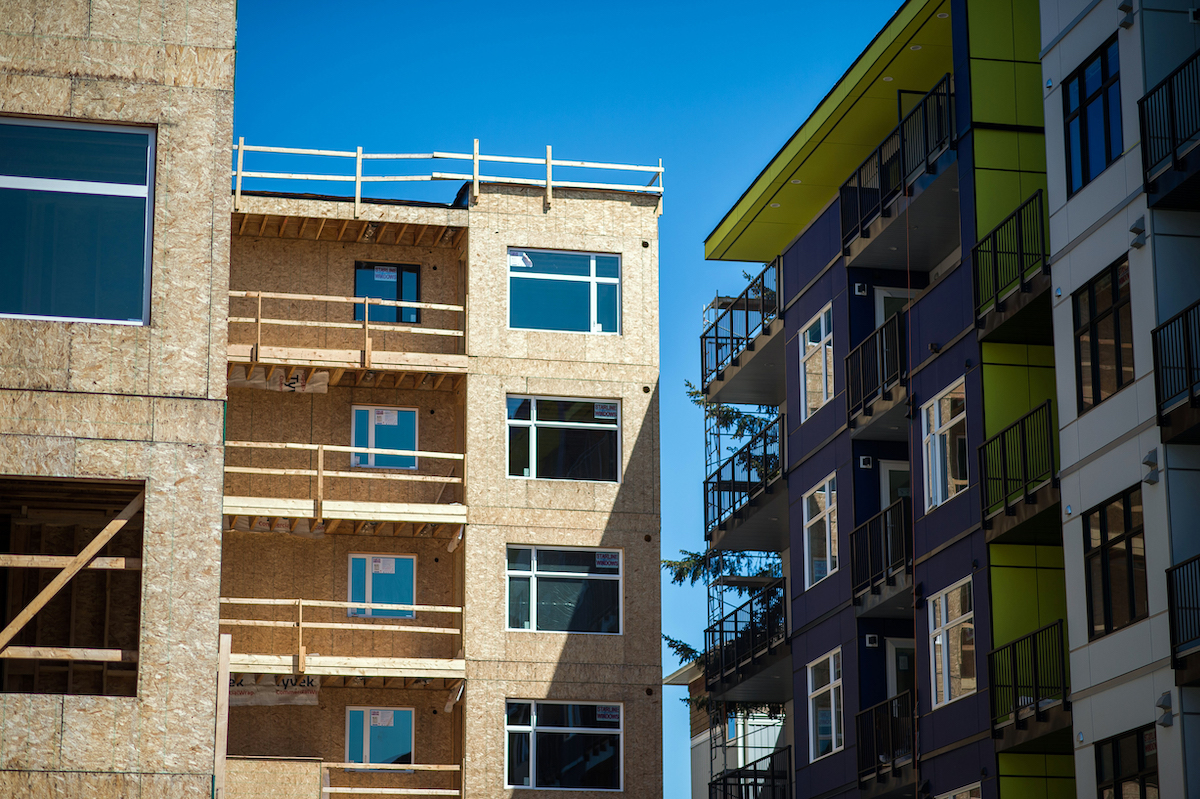
Langford’s population grew by over 31% in the past five years, making it the fastest-growing city in BC, and it doesn’t seem to be slowing down.
Before all those new people moved in, new homes were proposed, approved, and built, in an ongoing process that—if we look closely at any given moment—can help us see where the city is going.
Construction sites are dotted throughout Langford at varying stages: a wood-frame high rise is shooting up on Peatt Road, just a couple of streets over from an affordable apartment building underway on Jacklin Road, while at the edge of town on Luxton Road, a set of townhouses is being built. At any given council meeting there are between five and 15 rezoning or development permit applications on the agenda.
Mayor and council have made it a proud point that in Langford decisions are made quickly, efficiently, and without a lot of red tape. Developers pay higher fees, but get shovels in the ground quicker than in other municipalities. Of all the new homes built in Greater Victoria in 2021, more than a third (1,741) were in Langford: build it and they will come, the old adage goes. In the meantime, it’s a lot of public hearings, development-proposal open houses, and rezoning applications to keep straight.

So The Westshore has built a map showing all the recent applications, and we’ll keep updating it with each council meeting. Green pins show approved permits, while orange shows those still in process with staff or at council. We’ve focused just on residential permits, not other kinds of developments like business parks, daycares, or cannabis stores. Click on the pin to see the number of units, the type of proposal, who the owner is, and when it was last before council.
There’s more information we could layer in, and would love to hear from you about what you’d find useful. Do you want to know about fire or flood zones? Where the schools are, or biking trails, or transit routes? Is there a development proposal that’s missing? Let us know at newsletter@thewestshore.ca.


.jpeg)
.jpg)


